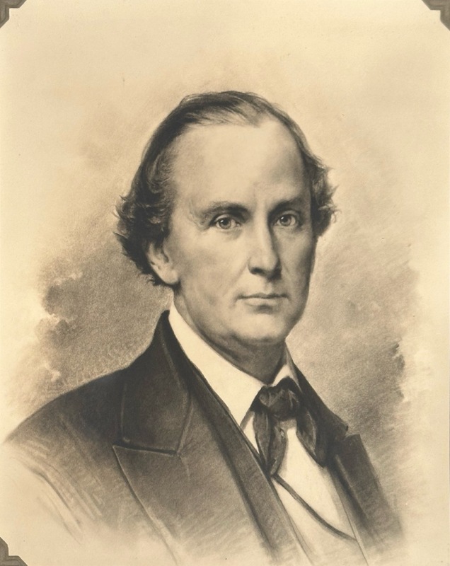
Sanford was the defendant in the Supreme Court case Dred Scott v Sanford, which concluded that black people could not be considered citizens of the United States.
John Richard Barrett (b. 1825) is listed as a landowner in 1852 plat maps of the region that is now Tyson Research Center; he and his uncle, Richard, bought and sold various parcels of land in what is now Tyson and the surrounding environs during the decade leading up to the Civil War. Barrett was a prominent member of the St. Louis community at the time and was elected to Missouri state legislature in 1852. Barrett supported the Missouri Pacific Railroad, which broke ground in 1851 and eventually laid track north of the Meramec River and near Barrett properties in and around Tyson. Purchasing land in the area may have been a family effort to speculate on land value increases due to the construction of the Missouri Pacific railroad line. Barrett’s station, just east of Tyson across the Meramec on the Missouri Pacific line, is named for J.R. Barrett. According to the Kirkwood Historical Society, “J. R. Barret ... owned 236 acres on the west side of Barrett Station Road. He purchased this land in 1851. Three months after purchase, he signed a deed with the Pacific Railroad allowing the railroad to have the rights across his land for $5.00 while keeping the timber rights. He lost this land in 1865 when it was sold on the courthouse steps due to his default on the loan.”1
While he supported the protection of slavery in states where it already existed, he opposed the expansion of slavery in new states and territories. Barrett, his mother, and his uncle were all enslavers. J.R. Barrett is listed as enslaving and leasing six people in the 1860 federal census. He stood as security for Louis, Oscar Early, and John Evans when they applied for freedom licenses in 1853, 1860, and 1861, respectively.
John Franklin Kerr (1832-1902), born to Thomas Gordon Kerr and Margaret Johnston Calbreadth, owned property in 1838 within present-day Tyson. Kerr's father died when he was two years old, and likely left the land in John's name. Kerr married Martha Green in 1853 and they had at least one son, David G. Kerr.
The Kerr family were enslavers. In the 1830 Census, St. Louis Middle Ward, they were listed as enslaving a girl and a boy between the age of 10-23, and a man between the age of 24-35.
John David Coalter (d. 1864) owned land that later became part of Tyson Research Center according to plat maps from 1862, 1870, and 1878. Coalter was a politician and lawyer. He was elected as a representative for St. Charles County to the Missouri State Legislature in 1836, 1838 and 1844. He was a delegate to the Missouri Constitutional Convention in 1845.
On July 11, 1864, John D. Coalter emancipated Lucy Ann White, the daughter of a couple enslaved by his late wife’s parents, John and Mary Means. Coalter's will emancipated Benjamin White after his death on October 19, 1864.
John Breckenridge Wells (1800-1890) was born in Kentucky and moved to Missouri in 1833. He owned land that is today part of Tyson Research Center according to a plat map of 1838, the same year that an enslaved woman named Virginia obtained her freedom from him.
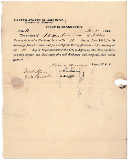
This is a declaration of bankruptcy by John Berry Meachum, dated 10 June 1842. The hearing date is dated 10 September 1842. James Hannon (?) is the clerk; Wm. Milburn (?) is the commissioner; N. M. Garseho (?) is the assignee.
Joel Bugg Hollman (1856-1926) was born, raised, and died in Iron County, Missouri. He shared land in what is now Tyson Research Center with Christian Morshall in 1909 and is later identified on a 1930 plat map as the sole owner of the land, likely part of his estate after his death.
Jesse C. Swanigan was among the first Black undergraduates admitted to Washington University after its 1952 desegregation. Initially a student in the College of Arts and Sciences, he later completed his degree in 1966 through the School of Continuing & Professional Studies. Reflecting on his early experiences, Swanigan described both the excitement of new opportunity and the pressure of representing the entire Black community on campus. His perseverance embodied the complex realities of integration at a university still grappling with its segregated past.
Jemmy was four months old when he and his mother, Sarah, were sold at a public auction the entrance of the St. Louis courthouse to settle the estate of their deceased enslaver, Eliza Brown. Henry Shaw purchased them at this auction for $600 on October 16, 1850.
James L. Sweatt III became the first Black graduate of Washington University’s School of Medicine in 1962. During his admissions process, he endured excessive scrutiny not faced by white applicants, yet he excelled academically and professionally. Sweat’s achievement represented a major breakthrough in the integration of the university’s professional schools. Sweatt later became a cardiothoracic surgeon, served on the board of Parkland Memorial Hospital, and in 1995 became the first Black president of the Dallas County Medical Society. His determination helped open doors for future generations of Black physicians.
James Compton Sutton, Jr. (1847 – 1914) owned property on what is present-day Tyson according to 1862, 1870, and 1878 plat maps. His father, James Sutton, Sr., moved to Missouri in 1819 to assist his uncle, John Sutton, with their blacksmith shop, located at Second and Spruce Street in St. Louis. In 1826, Sutton Sr. purchased land from the Gratiot family.
The Suttons were enslavers. In 1830, James Sutton, Sr., held a young man in slavery in St. Louis. In 1850, he enslaved four people in St. Louis County, and in 1860, he held five people in slavery in St. Louis Central Township.
Jim Kennerly was sold to Henry Shaw at an auction held at the St. Louis courthouse on January 1, 1852 when he was about 25-30 years old, as part of the estate of his deceased enslaver Lewellyn Brown. He was part of a group of enslaved people who attempted escape on May 21, 1855, at the site known today as the Mary Meachum Freedom Crossing. They crossed the Mississippi River to Illinois only to find bounty hunters lying in wait to capture them. Jim Kennerly was able to evade capture along with a few others, as there is no record of him being captured and resold. The 1852 bill of sale for Jim written in ink shows a later update written in pencil that states he “ran away May 1855.”
James (Jakob) Charles Taussig (1827-1916), was a landowner on what is the current-day Tyson Research Center area according to plat maps. He worked as a lawyer and was the defendants’ attorney in an 1860s suit disputing an inheritance which included enslaved people. His cousin and brother-in-law was Charles S. Taussig (married to Anna Abeles). Taussig’s nephew Frank William Taussig (the son of William Taussig) was an influential American economist and Harvard professor, and an open advocate for eugenics.
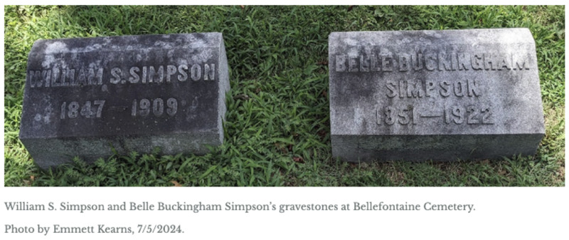
Isabel (Belle) Buckingham Simpson (1851 – 1922), daughter of Edward Buckingham, inherited land within what is now Tyson from her father, as shown on plat maps from 1873, 1893, 1909, and 1930. Plat maps show the emergence of a subdivision development on Buckingham’s property, called South Side in 1878 and 1893, Buckinghams Sub Div (South Side) in 1909, and Buckingham in 1930. On her mother’s side, Belle was the niece of another Tyson landholder, Horace Franklin Breed, Sr.
Isaac H. Fairham (1824 – 1899) owned property on land that is now part of Tyson Research Center according to plat maps from 1862 and 1870. Fairham enlisted as a private in the Union Army during the Civil War in May 1864.
Horatio B. Hawkins (1806 – 1886) purchased a tract of land within what is now Tyson Research Center in 1846 through the 1820 Land Grant Act that enabled the sale of public lands by the federal government. Not much is known about Hawkins’ life in St. Louis or his use of the land, which left his ownership at least by 1852, when his family appears to have moved to California. He appears in the 1845 St. Louis city census working in a coffee house with an adult man, an adult woman, and four boys in his household. In the 1847 city directory, he is listed as a pattern maker in business at 53 North Second Street and living at 168 Olive Street.
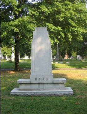
Horace Franklin Breed was born in Boston, Massachusetts and lived from 1824 to 1875. He owned land on what is now Tyson property according to plat maps from 1862 and 1870. He married Susanna P. Marlow. While evidence has not yet been identified that Breed was an enslaver, records indicate that members of the Marlow family were enslavers.
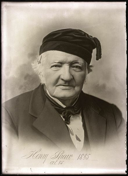
Early trustee and benefactor of WashU, founder of Botany Department; large landowner and slaveholder in 19th-century St. Louis; enslaved more than seventeen people; legacy includes Missouri Botanical Garden and Tower Grove Park.
Henry Clay Hart (1783-1867) appears as a landholder on maps of present-day Tyson land in 1857 and 1862. Hart was born in South Carolina, and in 1808 moved to Tennessee with his wife, Nancy Rainey. Hart received land grants in Arkansas, Illinois, and Missouri for his service in the War of 1812, which he gave to his children.
Henry C. Hart and his daughter Elizabeth L. Hart emancipated Susan, a 25-year-old woman described as married to George Kibby on December 4, 1855. It is possible, but not confirmed, that a Henry Hart in the 1840 St. Louis census who enslaved one young woman was the same Henry C. Hart. According to the 1860 Census, H. Clay Hart enslaved 14 people in Carondelet: three women ages 60, 30, and 22, four men ages 35, 32, 24, and 21, a 17-year-old youth, four boys ages 13, 10, 6, and 4, and two girls ages 3 and six months.
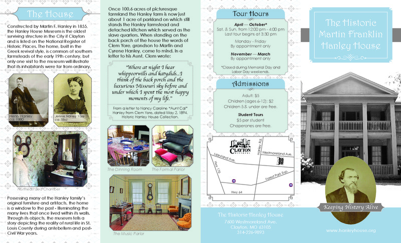
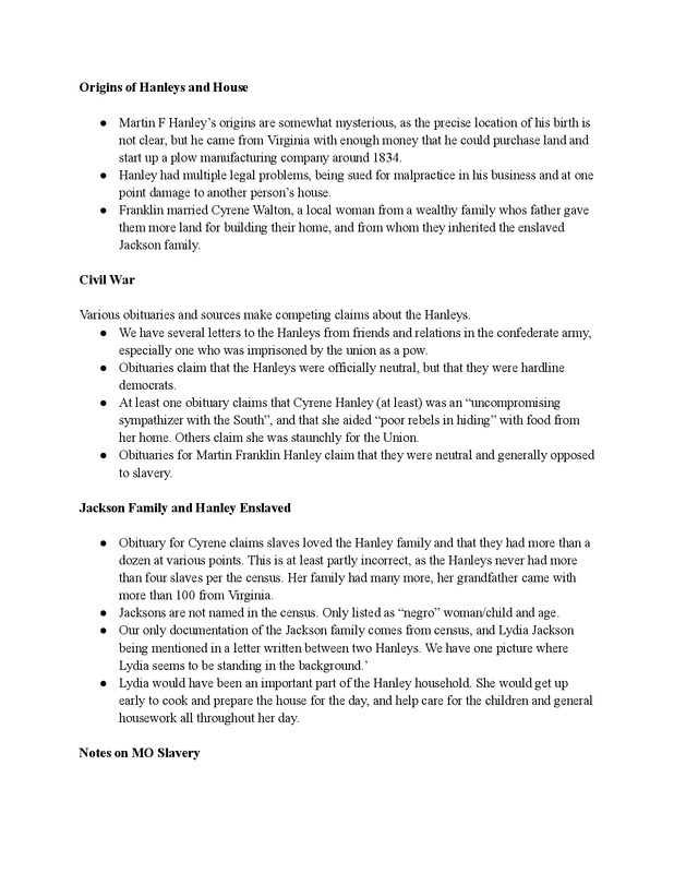
Martin F Hanley came from Virginia and inherited the enslaved Jackson family from his father-in-law. Cyrene, Hanley's wife, is cited as being an "uncompromising sympathizer with the South." Lydia Jackson was the only named enslaved person there and she was a vital part of the Hanley household specifically in regards to the domestic labor.